In the world of geospatial data and 3D modeling, precision is everything. Whether captured by aerial LiDAR or ground-based scanning, point cloud data serves as the foundation for countless applications—from construction and infrastructure to forestry and powerline inspection.
However, due to the limitations of LiDAR sensor performance and environmental interference, automatically reconstructed point clouds may contain noise or misclassified elements. These issues often require manual post-processing for optimization.

DJI Modify V1.4 Officially Released
Recognizing these pain points, DJI introduces Modify V1.4, a powerful update that transforms how professionals approach point cloud editing. It delivers a comprehensive intelligent point cloud editing workflow. It introduces advanced preprocessing tools, intelligent editing capabilities, enhanced output formats, and 3D Profile tools. These features help users quickly and efficiently generate high-quality, analyzable point cloud data.

Point Cloud Preprocessing
1. LAS File Import
DJI Modify supports smooth editing of ultra-large-scale point cloud data, with a maximum of 4.2 billion points per LAS file. It can load point cloud files up to half of the available system memory. For example, with 30GB of available RAM, you can load approximately 15GB of point cloud data.
The software is compatible with various sources of LAS data, including those from aerial LiDAR surveys and ground-based scanning.
2. Smoothing, Noise Reduction, and Density Adjustment
After creating a new project and selecting a LAS point cloud data file, DJI Modify can perform smoothing, noise reduction, and point cloud density adjustments on the LAS data, enhancing the overall quality of the point cloud through automated algorithms.

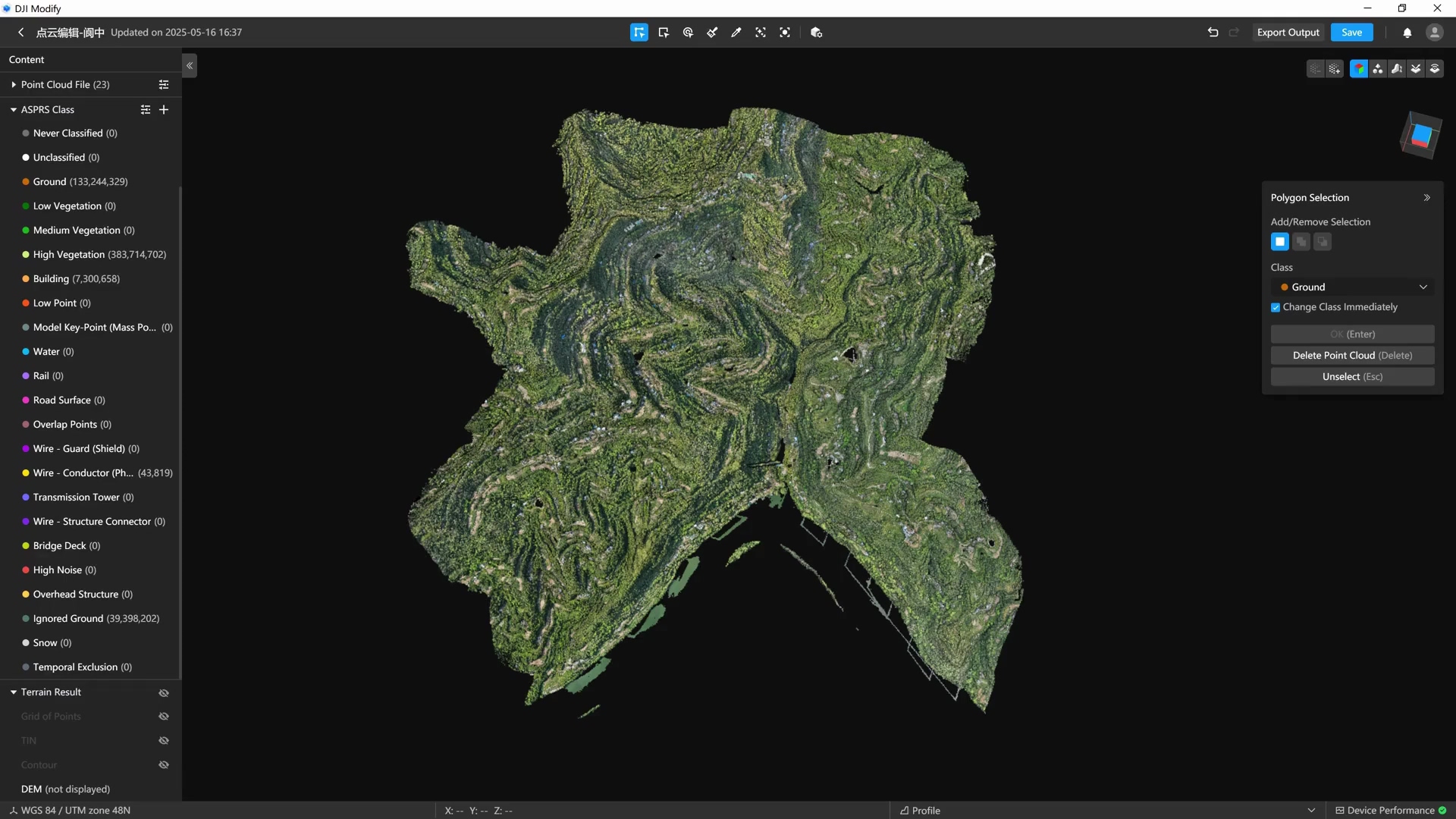
3. Automatic Point Cloud Classification
DJI Modify uses intelligent classification algorithms to automatically assign points to categories including:
Ground
Vegetation
Buildings
Wires
Electric Towers
Dynamic objects
Vehicles

The software also supports reclassification or terrain classification after importing point clouds.
*Smart Classification: Ideal for urban or multi-building scenes, supports earthwork or terrain surveying.
*Terrain Classification: Separates ground from non-ground points.

Intelligent Point Cloud Editing
DJI Modify employs a proprietary point cloud rendering system for a smooth 3D editing experience. The EDL (Eye-Dome Lighting) display mode enhances the visibility of point structures. It supports multiple viewing options:
RGB
Classification
Elevation
Reflectivity
Number of Returns
RGB Overlaid on Classification
The model view can also display both the coordinate system and point coordinates under the cursor.