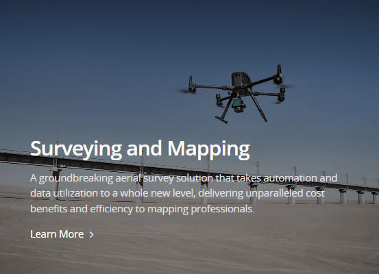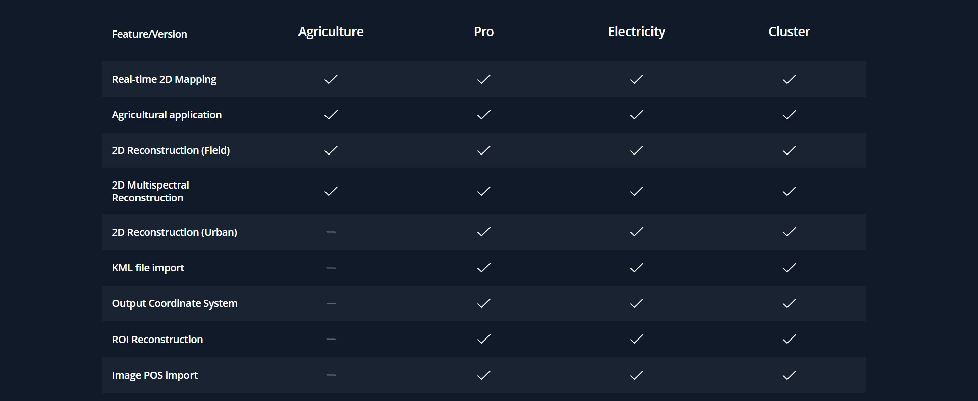
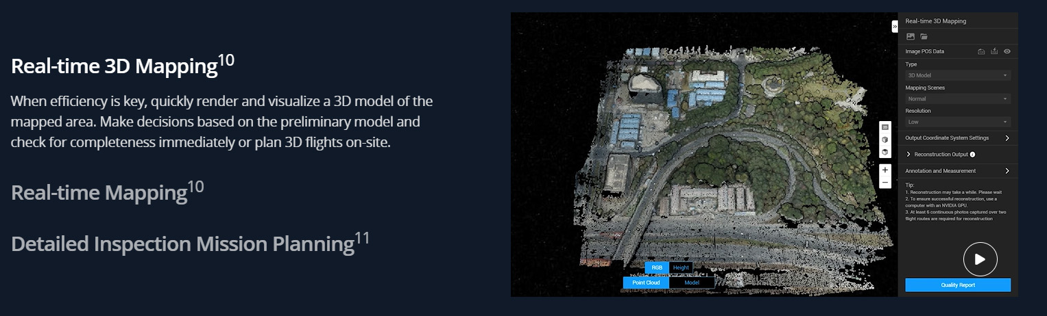
Imports images captured from multiple angles, to auto-generate a realistic 3D model.
Three resolutions available––high, medium and low––for image reconstruction in
diverse scenarios, such as surveying and mapping, accident sites, power grid equipment,
and progress-tracking for construction projects.
400 photos/1GB 2
(single computer)
6,000 photos/1GB3
(cluster processing)
30,000 photos/3 days4
Efficiency
30,000 photos/21 hours5
(cluster processing)
Centimeter-level accuracy6

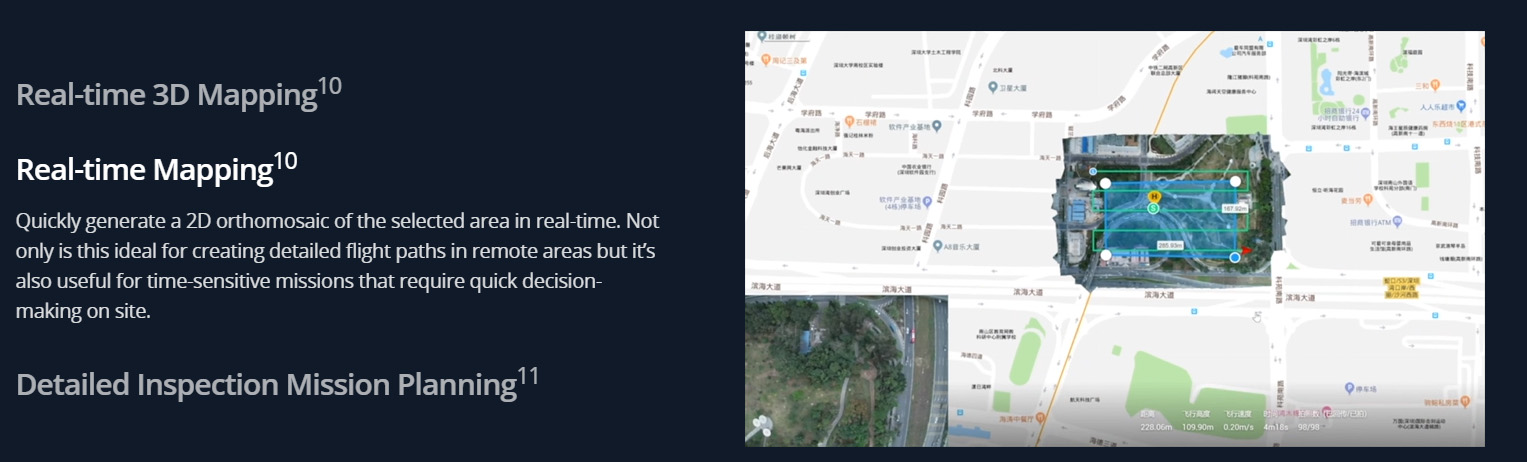
Generate high resolution orthomosaics, enabling you to get detailed and accurate measurement results for all your critical projects.
400 photos/1GB2
(single computer)
6,000 photos/1GB 3
(cluster processing)
5,000 photos/2 hours7
(single computer)
5,000 photos/80 minutes8
(cluster processing)
Centimeter-level accuracy
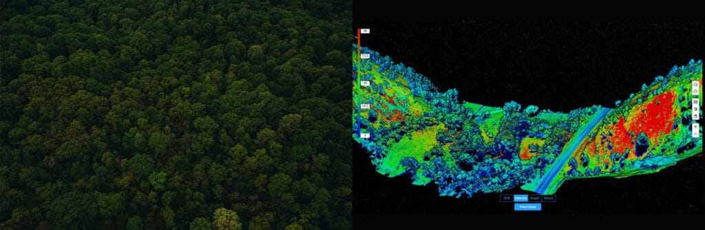
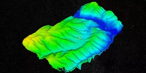
Process point cloud data captured by the Zenmuse L1 in DJI Terra. In just one click, calculate POS data, fuse point cloud and visible
light data, export point clouds in standardized formats, and generate fieldwork reports.
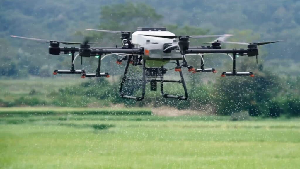
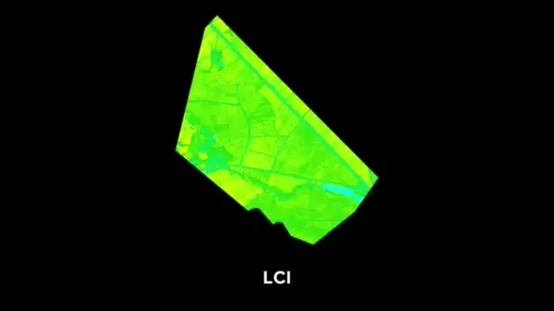
Using multispectral data from P4 Multispectral, generate radiometrically calibrated reflectance maps for remote sensing research
and more, or produce vegetation index maps including NDVI and NDRE. Create prescription maps for variable rate application
using DJI’s Agras drones to improve crop yields while driving down costs.

A simple and intuitive interface that gets you flying in no time.
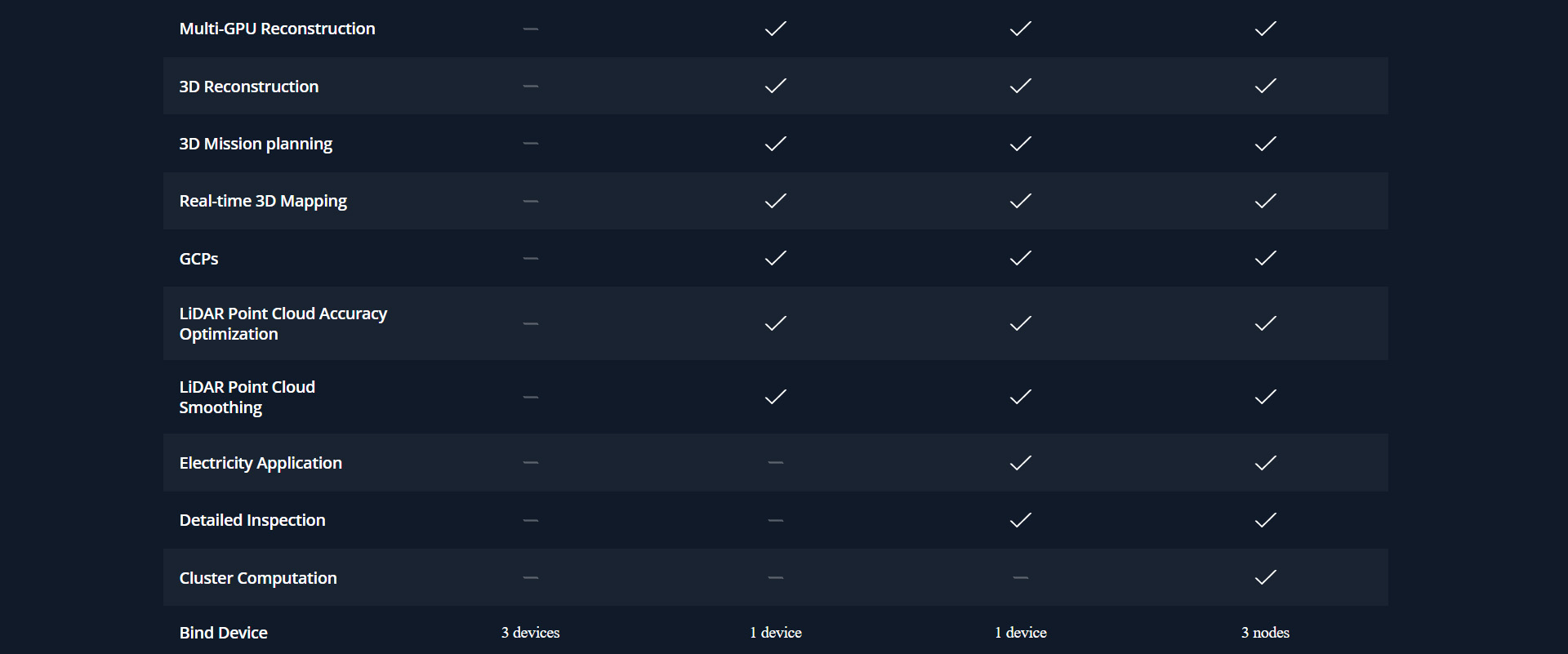
Run reconstruction missions by employing multiple graphics cards simultaneously to improve efficiency.

A simple and intuitive interface that gets you flying in no time.
Run reconstruction missions by employing multiple graphics cards simultaneously to improve efficiency.

A simple and intuitive interface that gets you flying in no time.
Run reconstruction missions by employing multiple graphics cards simultaneously to improve efficiency.
Incorporate POS data, GCPs, or both sets of data to create georeferenced maps and models with enhanced accuracy directly in the target coordinate system required by the project.
Convert the coordinates of your maps and models into 8500+ major coordinate systems by simply selecting the output that fits your needs.
View a quality report of your mission to ensure the results meet your accuracy standards.
With Region of Interest, image reconstruction can be performed to specific target region. In turn, this saves processing time and improves efficiency, while generating a clearer model or point cloud.

POS
Incorporate POS data, GCPs, or both sets of data to create georeferenced maps and models with enhanced accuracy directly in the target coordinate system required by the project.
Convert the coordinates of your maps and models into 8500+ major coordinate systems by simply selecting the output that fits your needs.
View a quality report of your mission to ensure the results meet your accuracy standards.
With Region of Interest, image reconstruction can be performed to specific target region. In turn, this saves processing time and improves efficiency, while generating a clearer model or point cloud.

GCPs
Incorporate POS data, GCPs, or both sets of data to create georeferenced maps and models with enhanced accuracy directly in the target coordinate system required by the project.
Convert the coordinates of your maps and models into 8500+ major coordinate systems by simply selecting the output that fits your needs.
View a quality report of your mission to ensure the results meet your accuracy standards.
With Region of Interest, image reconstruction can be performed to specific target region. In turn, this saves processing time and improves efficiency, while generating a clearer model or point cloud.

ROI

Acquire key dimensions across an array of terrains with easy-to-use analysis tools that enable you to obtain a variety of measurement data based on linear, area and volumetric measurements.
Edit labels of measurements on existing models, which can be used for reporting and improving communication throughout ongoing projects.


Waypoints Mission Planning
Create automated flight missions around roads and railways by simply drawing a line on the map.
Adjust mission settings to change the total area mapped, giving you the flexibility to choose
between creating high-definition 2D maps and 3D models or quick overviews.


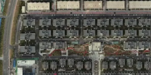
Area Mission Planning
Create automated flight missions around roads and railways by simply drawing a line on the map.
Adjust mission settings to change the total area mapped, giving you the flexibility to choose
between creating high-definition 2D maps and 3D models or quick overviews.


Oblique Mission Planning
Create automated flight missions around roads and railways by simply drawing a line on the map.
Adjust mission settings to change the total area mapped, giving you the flexibility to choose
between creating high-definition 2D maps and 3D models or quick overviews.


Corridor Mission Planning
Create automated flight missions around roads and railways by simply drawing a line on the map.
Adjust mission settings to change the total area mapped, giving you the flexibility to choose
between creating high-definition 2D maps and 3D models or quick overviews.